From Dive Sites to Data Points: Behind the Scenes with the Important Shark and Ray Area Initiative
- Adrianna Pisarczyk
- Feb 28
- 7 min read
Updated: Mar 2
INTRO
Now that the Important Shark and Ray Area (ISRA) Australia and Southeast Indian Ocean region has been mapped (with 158 ISRAs identified), I wanted to share what that process looked like behind the scenes: the long days of literature mining, the forensic-level scrutiny of citizen science platforms, the meticulously organised spreadsheets, and the inspiring collaboration that made the final map possible.
ABOUT ME
Hi, I’m Adrianna! I have just recently completed my Master of Marine Biology at James Cook University and have been part of the Fish and Fisheries Lab since February 2024. During this time, I have worked on applied research focused on sharks and rays to guide fisheries management, threatened species conservation, and marine park planning.
I recently completed my placement with the F&F lab, working as a research assistant with the Important Shark and Ray Area (ISRA) project--an initiative of the International Union for Conservation of Nature (IUCN) Species Survival Commission (SSC) Shark Specialist Group (SSG) that identifies and maps critical habitats for sharks, rays, and chimaeras worldwide. My interests centre on developing evidence-based management frameworks that integrate ecological dynamics and socioeconomic considerations to support targeted shark conservation and shark-human conflict mitigation strategies.
Before JCU, I completed my BSc with Honours in Marine Biology at the University of St Andrews in Scotland and gained various field and analytical experience through internships and research roles across French Polynesia, Indonesia, Fiji, Bermuda, and South Africa. Much of this work focused on marine conservation, environmental monitoring, and ecosystem health assessments-- the “boots on the ground” side of marine biology. The ISRA initiative gave me a valuable perspective on the other side of the process: how those field datasets become structures, defensible frameworks that inform policy.

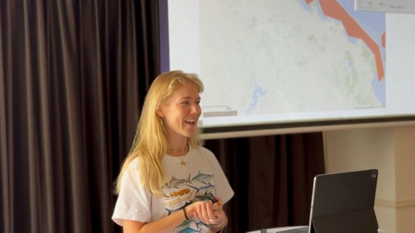
Presenting at the Important Shark and Ray Area’s Regional Expert Workshop in Adelaide, Australia
ABOUT ISRAs
What are ISRAs?
ISRAs are discrete portions of habitat identified as critical for the long-term persistence of shark, ray, and chimaera populations. Areas are delineated using a structured set of scientific criteria that consider species vulnerability, range restriction, key life-history functions (e.g. reproduction, feeding, movement), and special attributes.
Why map ISRAs?
Sharks and rays do not use ‘the ocean’ as a uniform space. They depend on particular locations at particular times to complete essential life stages: nursery areas, mating grounds, feeding sites, aggregation points, and migration corridors. Their spatial ecology is not so different from our own. We move between distinct places that serve different functions: home for rest, workplaces for productivity, supermarkets for food, roads that connect it all. The same principle applies underwater. Without knowing where these habitats are, conservation measures risk being placed in areas that are administratively convenient or politically expedient rather than ecologically meaningful. Mapping ISRAs helps ensure that conservation and management efforts align with the habitats that genuinely support population viability.
ISRAs are designed to be policy-relevant tools: they translate ecological evidence into mapped boundaries, documented habitat functions, and temporal patterns of site use that can inform marine planning and management.
How are ISRAs used?
While ISRAs are not Marine Protected Areas (MPAs) themselves, they provide a scientifically robust foundation that governments and organisations can use when prioritising spatial protection and management actions.
This has important implications for global initiatives such as the UN’s Global Biodiversity Framework “30×30” target (protecting 30% of land and sea by 2030). Evidence-based approaches like ISRAs help ensure that future conservation efforts are strategically targeted toward areas of greatest ecological importance, placing sharks and rays clearly on the map. ISRAs can also inform management within Exclusive Economic Zones, contribute to international policy frameworks, and support planning in data-limited regions.
MY ROLE AS AN ISRA INTERN
As a Research Assistant, I contributed to scientific synthesis, stakeholder coordination, and proposal development, translating complex information into defensible evidence aligned with ISRA criteria. I began by reviewing research on potential important shark and ray habitats across Queensland, screening virtually every peer-reviewed publication mentioning “shark” or “ray” across the region. From there, I integrated additional sources like local ecological knowledge, diver observations, and grey literature to fill key spatial and temporal gaps, including sorting through over 40,000 iNaturalist records across more than 250 species nationwide.
Much of my work centred on data management and analysis. Each proposed site required such detailed, systematic documentation that the process often felt like building a legal case: I assembled time-stamped imagery, ecological surveys, diver reports, telemetry studies, fisheries data, citizen science records, and even post-mortem or bycatch observations into criterion-based justifications. Keeping transparent audit trails ensured that each proposal was consistent, traceable, and ready for review.
Stakeholder engagement was another key component. I contacted around 400 dive centres and liveaboards across Australia, along with researchers, government experts, photographers, fishers, and citizen scientists. This involved building contact databases, coordinating communications, and turning informal observations into policy-relevant evidence. At the Regional Expert Workshop in Adelaide, I collaborated with contributors to refine site boundaries and strengthen proposals. Being part of this process really underscored both the rigour of the ISRA methodology and the value of cross-sector collaboration.
Across the regional assessment, I led more than 40 evidence-based proposals. Following independent review, these collaborative efforts identified 158 ISRAs and 35 Areas of Interest, supporting 95 species of sharks, rays, and chimaeras! These sites span diverse ecosystems, from shallow coastal nurseries to deepwater feeding and aggregation zones. You can explore these areas through the ISRA e-Atlas: https://sharkrayareas.org/e-atlas/! This region now brings the global total to nearly 1,000 ISRAs, supported by more than 1,500 contributors worldwide.

Section of the ISRA e-Atlas, showing the final Australian and Southeast Indian Ocean region
ISRA HIGHLIGHTS: Moments That Stood Out
When dive centres became key contributors
It was inspiring to see how engaged dive operators became. Many were eager to share observations or begin recording species sightings in more detail, contributing thoughtfully and generously despite busy schedules.
Seeing everyday observations become map-ready evidence
Seeing informal records-- dive logs, fishing photos, or anecdotal reports-- transform into mapped evidence was especially rewarding. The real fun came from those unlikely contributions you would never expect to work: a few questionable fishing Facebook groups turned into full-on detective work, deciphering true-blue Aussie slang from fishermen posting bull sharks mid-barbie, and translating “past the servo” into actual coordinates. With insufficient literature to back a potential bull shark nursery, those anecdotes and father-son photos proudly holding a neonate bull shark before releasing it back into the water suddenly made the case.
Meeting the people behind the papers
At the Regional Expert Workshop, meeting the senior researchers and government scientists whose work I have followed closely (and cited endlessly) was a big highlight. I absolutely had a few quiet fangirl moments.

Sub-set of Australia ISRA Core team members with Dr Chris Rohner (left background), Dr Asia Haines (foreground), Ryan Charles (right background)
ISRA CHALLENGES: Learning to Love the Spreadsheets
Data gaps
Many sites lacked recent datasets or peer-reviewed papers pinpointing exactly how, when, and which species used them. When the science was not there, you had to get creative and gather evidence from other sources. The rule was never to force a site through; it was to assess it honestly, and if the evidence fell short, pivot it potentially to an Area of Interest instead. Letting go of sites I was rooting for (but could not fully support) was definitely a challenge.
Ensuring the criteria were actually met
The ISRA criteria are not just checkboxes-- they are very precise, and Criterion C (life-history functions) was one of the toughest to nail. Criterion C1 (Reproductive Areas) needs clear evidence of mating, gestation, pupping, egg-laying, or true nursery functions. The presence of juveniles alone was not enough to designate a nursery area, as many shark species can be highly mobile after a year, so proof of neonates or young-of-the-year (YOY) was required. When scientific papers supplied species-specific size benchmarks for a site, this was more straightforward, but without them, iNaturalist or diver observations often lacked scale, turning every image into a puzzle: YOY or simply a small juvenile? I navigated this by extracting exactly what each piece of evidence supported (or didn’t), documenting uncertainties immediately, and reaching out to original photographers for clarification. Sometimes a quick “do you happen to have another photo with something for scale?” provided the critical detail needed to meet the criteria.
Tailoring communications to contributors
Reaching out to hundreds of different collaborators meant tailoring the approach for each audience: clear, encouraging prompts for dive centres (showing why their local knowledge and observations truly mattered); concise, technical requests for researchers and government experts; more casual but respectful outreach to fishers with full transparency on confidentiality. When approached the right way, busy people often made time to help :)
MY TAKEAWAYS
I learned how conservation is actually done
I have been very fortunate to have contributed to various fieldwork opportunities that gather the raw data feeding into research and marine planning, but this placement showed me how conservation actually happens in practice: the data synthesis, justification, reporting, and policy translation. While this might be seen as the less glamorous side of marine biology, these are the efforts that determine whether evidence turns into action.
The power of organisation
I learned how critical it is to maintain transparent, well-organised records, especially when coordinating hundreds of dive centres and species records. Spreadsheets tracked dive sites, coordinates, species sighted, depths, sizes, sexes, IUCN criteria, dates, observer details, and photo evidence-- ensuring every record was fully traceable and verifiable. This proved especially helpful for Criterion B (Range-Restricted species). Using the Atlas of Living Australia’s Spatial Portal, I layered species records and generated density-grid heatmaps where sighting frequency appeared as opacity gradients. Cross-referencing with dive logs and field data revealed overlooked “clumps” of range-restricted species in under-visited areas, identifying Criterion B sites missed by literature.
Communication fuels collaboration
I expected data analysis to be the main challenge, but much of the success came from working effectively with people. I found that trust, clarity, and communication often determine what knowledge contributors are willing to share. When some were too busy to respond, I tailored my approach with short follow-ups, bullet-point questions, and strategic phone calls to make contributing as easy as possible.

Attendees of the Regional Expert Workshop
FINAL THOUGHTS: Grateful for the Grind
I am genuinely grateful for this experience-- not just for the exciting outcome (seeing 158 ISRAs mapped across our region is a massive milestone), but for what it taught me about large-scale, data-driven, collaborative conservation.
I want to thank my supervisors Dr Michael Grant and Dr Andrew Chin, and the ISRA team-- especially Dr Rima Jabado, Dr Marta Palacios, Dr Chris Rohner, and Dr Asia Haines-- for their guidance, patience, and trust. And equally sincere thanks to every contributor who shared their knowledge, records, photos, and time.
This experience really showed me how powerful multi-stakeholder collaboration can be. Bringing together scientific research, citizen science, local knowledge, and policy expertise is what turns data into meaningful conservation outcomes. I am very grateful to have contributed to such a globally significant initiative.
With just a few ISRA regions left to map globally, I’m looking forward to seeing these remaining regions take shape-- and even more excited to watch ISRAs inform targeted protection for sharks, rays, and chimaeras in the years ahead.


Comments